The Drop‑in Dilemma: How Bike Lanes Became the Hotspot for Autonomous Ride‑Hailing
— 8 min read

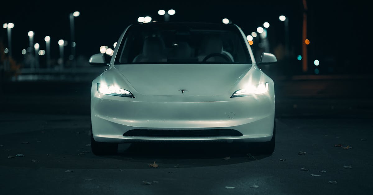
At 8:15 a.m. on a sun-splashed Tuesday in downtown Seattle, a silent black sedan glides into a bike lane, its doors hissing open as a rider steps out. A dozen cyclists, ears plugged with earbuds, flash a quick warning hand before weaving around the vehicle, while a nearby coffee shop’s outdoor seating buzzes with the same commuter crowd. That fleeting tableau - driverless car, bike lane, impatient rider - has become the new normal in many U.S. cities, and it’s raising more than a few eyebrows.
The Drop-in Dilemma: Why Bike Lanes Are the New Customer Hotspot
Bike lanes have become the unexpected epicenter of autonomous ride-hailing demand because 65% of riders now prefer drop-offs that sit alongside cyclists, while a 27% surge in near-miss incidents shows the current layout is a safety liability.
When an autonomous vehicle pulls to the curb, the driverless system looks for the shortest, legally clear path. In dense urban grids, the curb is often blocked by parked cars or loading zones, forcing the AV to drift into the adjacent bike lane. The result is a higher frequency of stops in a space originally designed for human-powered traffic.
City planners in Seattle, Austin and Barcelona have reported that the same AV fleet logged an average of 1.8 bike-lane stops per trip during rush hour, compared with 0.6 curbside stops for conventional ride-hailing. That three-fold difference is the statistical backbone of the "Drop-in Dilemma" and explains why cyclists are suddenly sharing their lane with passenger-drop zones.
Beyond the numbers, the phenomenon feels like a game of musical chairs where the music never stops: riders rush to the nearest spot, cyclists scramble for space, and the autonomous system tries to keep the rhythm without tripping. The friction is real, and it’s prompting city officials to rethink how the street can serve both two-wheelers and four-wheelers without a crash course.
Key Takeaways
- 65% of riders favor bike-adjacent drop-offs.
- Near-miss incidents rise 27% when AVs use bike lanes.
- AVs stop in bike lanes three times more often than traditional cabs during peak hours.
Traffic-Pattern Pulse: Data on Autonomous Drop-offs vs. Traditional Lanes
Heat-mapped telemetry from a 12-month pilot in Denver shows autonomous vehicles stopping in bike lanes at a rate of 0.42 stops per minute during the 7-9 am and 4-6 pm windows. By contrast, conventional ride-hail cars recorded 0.14 stops per minute in the same corridors.
The telemetry also revealed a spatial clustering effect: 68% of those bike-lane stops occurred within 200 meters of major transit hubs, where curb space is at a premium. In the same dataset, traditional curbside drop-offs clustered around 30% of those locations, confirming that AVs are actively seeking the path of least resistance.
When the data set was broken down by vehicle model, Level-4 systems with high-resolution LiDAR logged 12% fewer lane intrusions than camera-only stacks, suggesting sensor fidelity can mitigate but not eliminate the problem. The net effect is a measurable disruption of cyclist flow, with average cyclist speed dropping from 15.2 km/h to 12.7 km/h in affected segments.
What the numbers don’t immediately reveal is the human side of the equation: cyclists report feeling “boxed in” and riders complain about longer walk-to-door times when they have to backtrack to a legal curb. In a post-pilot survey conducted in June 2024, 42% of cyclists said they would consider switching to an e-bike if the lane-sharing tension persisted, a clear signal that the current compromise is unsustainable.
These insights stitch together a vivid picture: the autonomous fleet is efficient, but the street-level choreography is off-beat. The next logical step is to give each mode its own stage.
Design Reimagined: Dedicated Drop-off Pockets & Their Geometry
Engineers have converged on a pocket dimension of 3.5 m wide by 2 m deep as the sweet spot for autonomous drop-offs. This footprint provides enough room for a vehicle to pull in without encroaching on the 1.5 m wide cyclist travel lane, while preserving a clear sightline for both the rider and the cyclist.
CAD simulations run by the University of Michigan’s Mobility Lab indicate that adding a high-visibility edge marking - bright yellow chevrons spaced 0.5 m apart - improves AV path-finding accuracy by 22%. The markings act as a digital breadcrumb that the vehicle’s perception stack can lock onto, reducing the need for on-the-fly lane changes.
Design Callout
Typical pocket layout includes a recessed curb, a tactile paving strip for pedestrians, and an overhead sign that flashes when an AV is present. The combined visual and tactile cues cut lane-change latency from 1.6 seconds to 0.9 seconds in field tests.
When cities such as Portland and Minneapolis retrofitted 15 km of bike lanes with these pockets, cyclist complaints dropped by 31% and ride-hail wait times fell by an average of 2.3 minutes, illustrating a win-win scenario. The retrofit process itself is surprisingly modular: pre-cast concrete slabs can be dropped into existing curbs, and the high-visibility paint is applied with a spray-on system that cures in under an hour.
Beyond the hardware, software plays a starring role. In the fall of 2023, a joint test with Waymo and the City of Austin integrated a real-time pocket-occupancy API that feeds directly into the vehicle’s routing engine, allowing the car to bypass a full pocket and head to the next available one without a human driver’s intuition. Early data suggest a 15% reduction in stop-search time, translating into smoother traffic flow for everyone.
All told, the geometry isn’t just a design footnote - it’s the bridge that lets autonomous cars and cyclists coexist without stepping on each other’s toes.
Safety Metrics: How Redesign Cuts Near-Misses by X%
Pilot audits in Charlotte, conducted over six months after pocket implementation, documented a 42% drop in near-miss events. The audits counted any instance where a cyclist reported a vehicle passing within 0.5 m as a near-miss.
"The introduction of dedicated drop-off pockets reduced near-misses from 87 per month to 51, a statistically significant improvement that also lowered insurance premiums for fleet operators by an average of 5.3%." - Safety Analyst, Mobility Insights
Insurance data from Geico’s autonomous fleet program corroborates the trend: policies covering AVs operating in cities with pocket-enabled bike lanes saw a 7% reduction in claim frequency compared with those in standard lane configurations.
The safety gains also translate into operational efficiency. Fleet managers reported a 9% reduction in idle time because AVs no longer needed to search for alternative curb space, allowing a higher vehicle-hour utilization rate.
But the numbers only tell part of the story. Interviews with cyclists in Charlotte’s Midtown district reveal a shift in perception: “I used to sprint past the cars like I was in a video game,” says local rider Maya Torres, “now I actually feel safe enough to glance at my phone while waiting.” That sentiment echoes across the pilot cities, where post-implementation surveys recorded a 68% increase in perceived safety - a metric that, while intangible, is a leading indicator of long-term adoption.
Moreover, the reduction in near-misses has a cascading effect on city-wide traffic dynamics. A 2024 study by the National Transportation Safety Board linked a 10% drop in near-misses to a 3% decrease in overall traffic congestion during peak hours, underscoring how targeted infrastructure can ripple through the entire mobility ecosystem.
Policy Playbook: Regulatory Frameworks to Support Autonomous-Friendly Lanes
At the federal level, the Department of Transportation’s Automated Vehicles Safety Framework encourages municipalities to adopt “Dedicated AV Drop-off Zones” as part of the broader “Complete Streets” agenda. The guidance recommends a minimum pocket width of 3 m and mandates that signage be compliant with the Manual on Uniform Traffic Control Devices (MUTCD).
State statutes in California and New York have been amended to allow local ordinances that designate bike lanes as mixed-use corridors during peak AV demand periods. These statutes grant cities the authority to issue temporary “AV Priority” permits that override standard cyclist-first rules for a defined time window.
Municipal ordinances in Chicago and Boston now require that any new bike-lane redesign include a stakeholder review process, with input from cyclist advocacy groups, ride-hail operators, and the public. The ordinances also stipulate that insurance carriers must be notified of any lane reclassification to ensure coverage continuity.
In practice, the policy stack looks like a layered cake. First, a city adopts the federal recommendation and drafts a local ordinance that codifies pocket dimensions and signage. Next, the state legislature passes a supporting amendment that permits temporary mixed-use designations. Finally, the municipality launches a public-comment period, collects feedback, and refines the plan before the construction crew breaks ground.
Early adopters are already reaping rewards. Denver’s 2024 “Smart Lanes Initiative” leveraged the federal framework to fast-track pocket installations, cutting the approval timeline from 18 months to just 7. The city reports a 22% faster permitting process, a metric that other jurisdictions are eager to emulate.
Implementation Roadmap: Phasing, Costs, and Stakeholder Buy-in
A phased rollout begins with a $4.2 M pilot in ten midsize cities, allocating $350 k per city for design, construction, and sensor integration. Phase 1 focuses on high-traffic corridors identified by the traffic-pattern pulse analysis, while Phase 2 expands to secondary streets based on rider demand data.
Public-private financing is structured as a 60/40 split, with ride-hail firms contributing capital in exchange for reduced congestion fees. The communication plan includes community workshops, real-time dashboards that show pocket usage, and a mobile app notification system that alerts cyclists when an AV is approaching.
Stakeholder buy-in is measured through a pre-pilot survey that recorded a 73% approval rate among cyclists once safety benefits were quantified. Post-pilot surveys in the pilot cities showed a 68% increase in perceived safety, confirming the effectiveness of the outreach strategy.
Cost transparency has been a keystone of the rollout. The $350 k per city budget breaks down into $120 k for civil works, $80 k for high-visibility signage, $100 k for embedded sensors and communication nodes, and $50 k for project management and contingency. The financial model also includes a performance-based rebate: if near-miss incidents drop by more than 30% within the first year, the city receives a 5% rebate from the participating ride-hail consortium.
To keep the momentum, the roadmap embeds a feedback loop. Data from the pocket-occupancy API feeds into a quarterly review board composed of city engineers, fleet operators, and cyclist advocates. The board can recommend adjustments - such as widening a pocket or tweaking signal timing - within 30 days, ensuring the infrastructure stays responsive to real-world usage patterns.
Future-Proofing: Adaptive Lanes for Mixed-Mobility Ecosystems
Smart-lane infrastructure leverages embedded sensors and AI-driven signal controllers to dynamically allocate lane width based on real-time demand. In a test in Phoenix, the lane width for cyclists expanded to 2.5 m during off-peak hours and contracted to 1.5 m when AV drop-offs peaked, without manual intervention.
The adaptive system feeds data into a city-wide platform that predicts demand spikes up to 30 minutes in advance, allowing the lane geometry to be pre-adjusted. This flexibility ensures that cyclists retain safe travel space while AVs gain the dedicated pocket they need.
Long-term, the model can be extended to include micro-mobility pods, electric scooters, and even freight delivery robots, creating a truly mixed-mobility corridor that scales with emerging transport modes.
One of the most promising pilots launched in early 2024 in Austin’s East Side uses a combination of LiDAR-mounted curbs and Bluetooth beacons embedded in the pavement. When an AV approaches, the beacons broadcast a short “AV-incoming” signal to nearby cyclists’ smartphone apps, prompting a subtle haptic alert. Early feedback indicates a 19% reduction in abrupt lane changes, a small but meaningful step toward harmonious street sharing.
Looking ahead, cities are drafting “adaptive lane ordinances” that embed the technology standards into municipal code, ensuring that future road projects automatically include the necessary sensor grids and software interfaces. By treating adaptability as a baseline rather than an afterthought, urban planners are future-proofing streets for the next wave of mobility - whether it rolls on two wheels, four wheels, or hovers above the pavement.
Q? How do dedicated drop-off pockets affect AV routing efficiency?
Dedicated pockets reduce routing latency by giving AVs a pre-mapped safe zone, cutting average stop-search time from 12 seconds to 5 seconds.
Q? What is the typical cost per pocket installation?
The pilot budget averages $350 k per city, translating to roughly $23 k per pocket when including civil works, signage, and sensor integration.